×


Introduction
Estuaries are the spawning grounds for many marine organisms that eventually reside in ocean environments as well as serving feeding stops for migratory birds (Nordstrom, 1992). Humans have their most intimate contact with marine environments and their greatest impact in estuaries; both the value and vulnerability of estuaries are in their multiplicity of uses (Schubel, 1976). Understanding the value of the estuary as a natural reserve will provide a platform for improving the environmental conditions of the estuary as well as the relation of the community that benefits from it.


The estuary as a public park. Involving the community.
It has become increasingly important to incorporate the dynamic interactions between societies and natural systems (Berkes, 2003). Humans are part of ecosystems, therefore natural preservation of the ecosystem as well as human development must converge in a sustainable balance that requires interdisciplinary organization and a programatic plan of action. Success may rest in partitioning (zoning) these systems into categories weighted towards human uses (the anthropocentric component) and/or towards the conservation and/or preservation of lesser disturbed systems, or parts thereof (Weinstein, 2008). To conserve the estuary healthy, preventing deterioration and preserving the natural conditions of the environment is a determinant in from economic perspective, since a large part of the general income of the region comes from tourism.

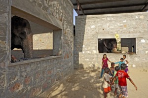
Building knowledge and ecological relationships is the basis for putting humans back in the ecosystem (Berkes, 2003). The attributes of adapting the estuary as a public space are essential to reverse the negative impacts that have been slowly but constantly emerging in the last decades, the community would need an active stimulation in order to achieve a positive involvement with the ecosystem, by experiencing the estuary from within. Putting humans back into the ecosystem requires using all possible sources of ecological knowledge and understanding as may be available (Berkes, 2003). The population of San Jose del Cabo that benefits from the estuary is conformed by residents, tourists, scientists, academic researchers, entrepreneurs and developers, among others.

Geology.
The riparian system of the Basin and Estero de San José is formed by a series of topographies, among which are the mountains of the Sierra de La Laguna, west and the Sierra de la Trinidad in the east. The first reaching maximum heights of about 1,900 m, the second presents maximum height of 700 m, the watershed with a diamond-shaped skirts on both mountains. Towards the lower parts of the basin are observed tables, motions and active river valleys. The soils that occur in the Cape Region are of coarse texture and low fertility.
Climate.
The climatic characteristics of the region derive primarily from its position
geographical south of the peninsula, which determines the incidence of three factors: high North Pacific subtropical pressures, phenomena that determine the conditions of dryness in the area, the impact of tropical storms and cyclones, which define the regime predominance of summer rainfall and the intensity of these, and the California Current causing a constant temperature inversion and rain, allowing the presence of winter rainfall.
Hydrological system.
The river San Jose is one of the largest current in the state of BCS. The basin
drains 1.235 km 'with a length of 78.05 km and an average gradient of 1%. the flow extraordinary water estimated maximum return period of 1, 000 years
According to the National Water Commission is 8,000 m3 / s.
The hydrology characteristics of the region are defined by climate and topography, which generates torrential local schooners and ephemeral, that in times of cyclones can develop a large volume that fills the lower parts, are reduced areas with a continuous flow, located in the main channels of the Sierra de La Laguna (northwest of the basin), which disappear when infiltrating the base of it. In San Jose station reported an average annual rainfall of 309.7 mm, with the months of August and September increased precipitation, with the lowest rainfall in March, April and May. The normal annual average temperature is 23.4 degrees Celsius, with a normal maximum of 29.5 degrees and can reach up to 40 degrees (November) and normal minimum of 17.2 degrees with peaks present in January and February (less than 10 degrees).

Biotic Factors.
Flora.
Currently, the vegetation is mostly annual or perennial herbs short life, the remainder is composed of perennial grasses and shrubs and tree seedlings (among them, are fan palms). This stage of succession can be considered as the stage of plant colonization by pioneer species that is established in the early stages of succession and are generally characterized by cycles short life and rapid growth. However, the presence of palm seedlings and other shrubs typical of mature or stable vegetation, indicate that this model of succession in the area corresponds to what has been called a model of tolerance, where pioneer species and cohabiting late from early succession stages.
Fauna.
The estuary of San José has a community of terrestrial and aquatic birds end practically exclusive south of the peninsula. The bird community is a resident species and migratory. It is the last rest station for waterfowl and shorebirds migrating to areas of southern Mexico, Central or South America. Currently the area and apparently altered have been drastic changes in the composition. Part of the fauna present in the estuary has several species of reptiles, amphibians and mammals, and in some cases species are endemic.
Anthropogenic Disturbances.
The lentic condition of the estuary enhance the process of eutrophication processes, both natural processes of inorganic nutrient input surface drainage, groundwater and the high human activity, such as the discharge of untreated urban wastewater that accelerate the eutrophication process which is unfavorable for the maintenance of aquatic characteristic of these environments. The lately increment of land use has decline the vitality of the estuary, caused by real estate development which affects both directly and indirectly, illegal harvesting of palm through complete extraction, and irregular construction of facilities within the reserve.

Strategic diagram.

Sections.

Park Master Plan.
---------
Since 2009, CAPALab has been bringing together the local community with the municipality government to initiate this commission to discuss the ecology, hydrology, biology, culture, history issues of this estuary, San Jose del Cabo, Mexico.
CAPALab's aim, by combining two main attractors (activities + green public areas), was to encourage the locals and visitors to use the estuary, and in turn take ownership of this essential natural resource. Such ownership will foster a greater interest in the environment and allow locals and visitors alike to be part of the conversation which brings together recreation, education and creativity for the future of the estuary.
'We believe that if 'the Estero' remains as it is without key public attractors, there is a great danger that this area could be developed for hotels (or similar) and this incredibly valuable asset will be lost forever.
Therefore we believe it is in everyone's interest to revitalise the estuary for the continuing prosperity of the San Jose del Cabo community, environment and region as a whole.' - CAPALab